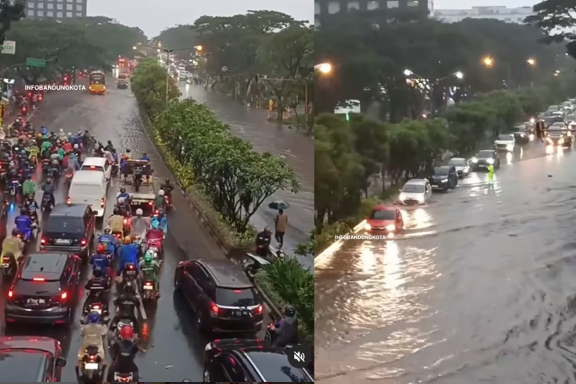

Bandung, Indonesia Sentinel — Several areas in Bandung and its surrounding regions were inundated with floods following torrential rains on Friday, January 24, 2025. Key locations affected by the flooding included Jalan Pasteur, Pagarsih, Pasirkoja, and Astanaanyar.
The downpour began Friday afternoon and intensified throughout the day, finally subsiding by nightfall. The high volume of rainfall overwhelmed drainage systems, resulting in widespread floods across Bandung, according to report from TribunJabar.
One of the worst-hit areas was the intersection of Jalan Terusan Pasirkoja and Jalan Astanaanyar, where a swollen river overflowed onto the streets, submerging them to the height of the sidewalks. Videos shared on social media showed vehicles stalled in the water, leaving drivers stranded as the floodwaters rose.
In Jalan dr. Djundjunan, also known as Pasteur, floodwaters caused severe traffic congestion. The water, which reached an adult’s knee height, paralyzed traffic along the road’s two main lanes. The resulting gridlock extended into central areas of the city, including Jalan Pajajaran and the Mochtar Kusumaatmadja flyover.


Similarly, Jalan Pagarsih saw muddy floodwaters rushing from an overflowing river, engulfing streets and submerging street vendors’ carts and parked vehicles. Meanwhile, in Jalan Sukajadi, floodwaters flowed rapidly from the higher northern regions, forcing motorists to navigate against the current on uphill roads.
Reports and videos circulating on social media also highlighted flooding in residential areas, including neighborhoods in Cimahi and Dayeuhkolot. Residents in these areas continued to grapple with the aftermath of the floods into Saturday morning, January 25, 2025.
Meteorological Data and Forecast
According to Tempo, the Meteorology, Climatology, and Geophysics Agency (BMKG) reports that Friday’s rainfall in Bandung reached an extreme intensity. Rainfall recorded at 67.8 millimeters per hour between 4:20 p.m. and 5:20 p.m. local time. The daily rainfall total reached 111 millimeters, classified as “very heavy rainfall.”
In Cimahi, rainfall during the same period was recorded at 42 millimeters per hour, with a daily total of 64.1 millimeters, categorized as “heavy rainfall.”
BMKG’s West Java Climatology Station attributed the heavy rains to the active phase of the Madden-Julian Oscillation (MJO), which was detected over the Indian Ocean. This weather pattern contributed to increased cloud formation and subsequent rainfall in the region.
Read also : Indonesia Weather Alert! Severe Flooding Hit Multiple Region Across Central Java Amid Extreme Weather
BMKG has warned of potential heavy rain accompanied with thunderstorms and strong winds in parts of Bandung and its surrounding areas over the next three days. Residents are urged to remain vigilant and take necessary precautions as weather conditions remain unstable.
(Raidi/Agung)


