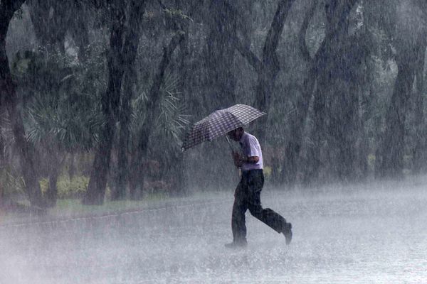

Jakarta, Indonesia Sentinel — The Indonesian Meteorological, Climatological, and Geophysical Agency (BMKG) has issued a warning regarding the potential increase in rainfall intensity across West Java. The agency predicts Indonesia weather alert with extreme rainfall in the region from February 2 to February 7, 2025, due to the development of a tropical cyclone seed in the Indian Ocean.
BMKG’s head, Dwikorita Karnawati, addressed the public on Saturday, February 1, noting that the presence of the tropical cyclone seed could pose a threat to shipping activities, potentially affecting both the public and maritime operations, either directly or indirectly.
“This is related to the emergence of a tropical cyclone seed in the Indian Ocean, which could endanger maritime activities,” she said during a digital press conference.
Dwikorita further explained that most regions in Indonesia, including West Java, are still experiencing the peak of the rainy season, which is expected to last until the end of February or March 2025. This ongoing Indonesia weather condition is influenced by the strengthening of the monsoon winds from Asia and the presence of a weak La Niña phenomenon, which is forecast to persist until March-April.


Additionally, she highlighted the role of the Madden-Julian Oscillation (MJO), which is moving toward central Indonesia, and the impact of cold air currents from high-altitude areas in Asia, including Siberia. “These conditions have been present for several days, alongside localized atmospheric instability in several regions of Indonesia, and the ongoing influence of equatorial waves that will continue for the next week,” Dwikorita explained. “What’s new now is the appearance of tropical cyclone seeds in three different locations.”
The cyclone seeds include 90S located south of NTT-NTB, 96P in the Gulf of Carpentaria, Papua, and the closest one to West Java, 99S, south of Banten. “These are new players, in addition to the ongoing weather patterns we’ve been experiencing in recent days,” she added.
Due to the tropical cyclone seeds, BMKG warned of the potential for heavy rainfall that could develop into extreme conditions across a broad range of areas, including Papua, NTT, NTB, Bali, East Java, Central Java, Yogyakarta, North Kalimantan, East Kalimantan, North Maluku, West Java, and Jambi.
In addition to the anticipated rainfall, strong winds and waves reaching 2.5 to 4 meters in the Indian Ocean from Bengkulu to NTT are also a concern. These weather patterns could affect maritime safety, particularly along the southern coast of Java and other affected regions.
Read Also:
BMKG’s Acting Secretary Guswanto also mentioned the likelihood of cumulonimbus cloud formation between February 2 and February 7, 2025, with coverage ranging from 50-75 percent in areas including the Indian Ocean, Malacca Strait, Aceh, North Sumatra, Java Sea, Bali, Nusa Tenggara, Banda Sea, West Papua, and Papua.
He emphasized that cloud coverage exceeding 75 percent, which poses a significant hazard to aviation, is expected over the southern Indian Ocean off the coast of Java, Aceh, the Flores Sea, Banda Sea, as well as the northern Pacific Ocean off Papua and Arafura Sea.
With the potential for extreme weather in these regions, authorities urge residents and travelers to remain vigilant and take necessary precautions. BMKG will continue to monitor the situation and provide updates as necessary.
(Becky)


